
Public Hearing: Hogan-Pancost Annexation


Public Hearing: Hogan-Pancost Annexation
(5399 Kewanee Dr. & 5697 South Boulder Rd.)
Date of Vote: 2/19/2026
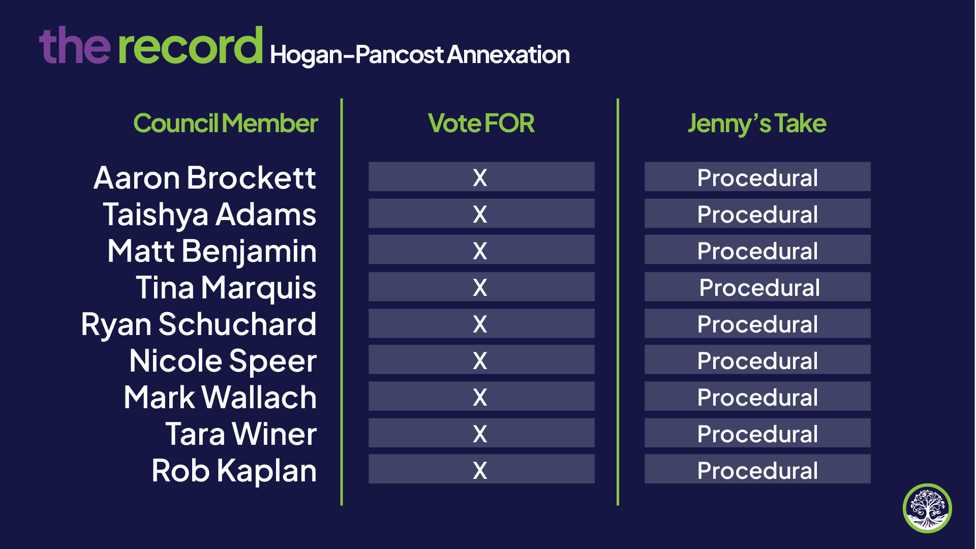
Vote: Unanimous (Procedural)
What happened
City Council held a public hearing on an annexation request for approximately 24.04 acres of city-owned land located at 5399 Kewanee Drive and 5697 South Boulder Road, including portions of the 55th Street right-of-way.
The bundled action items included:
Adopting Resolution 1370 (findings of fact and conclusions)
Adopting Ordinance 8734 on second reading (annexation + initial zoning)
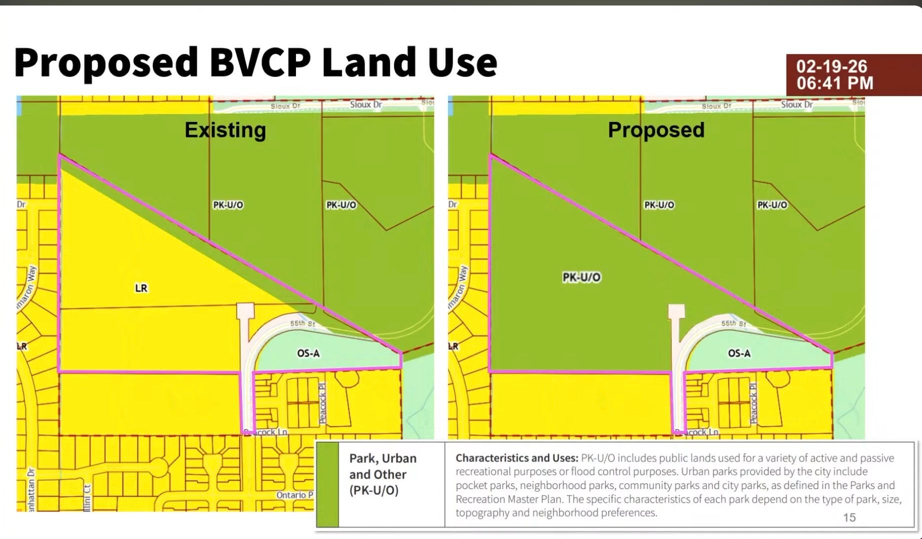
Amending the BVCP Land Use Map for the roughly 19 acres west of 55th Street from Low Density Residential to Park, Urban and Other (PK-U/O)
Planning Board previously recommended unanimous approval, and Council also approved the package unanimously.
Important historical context:
The property has been city-owned since 2019, when Council purchased it to support parks & recreation uses and flood mitigation on the western portion of the site.
No specific development plan was approved with this vote, this action primarily aligns jurisdiction and long-range planning designations.
What it means
Why the annexation matters
Annexation + zoning + BVCP map changes are the formal mechanics that:
- Bring land fully under City of Boulder jurisdiction
- Establish the city’s regulatory authority
- Align long-range land use expectations
In this case, the city is positioning the west-of-55th acreage for parks, recreation, and flood management purposes, consistent with the 2019 acquisition strategy.
City staff also described the area as a “special opportunity” tied to future expansion of East Boulder Community Park.
Why Council voted yes
Alignment with prior Council direction
Because the property was already purchased in 2019 for public purposes, the annexation largely formalizes an existing policy path.
Administrative clean-up
The BVCP map previously showed Low Density Residential, a designation from when the land was privately owned. Updating the map removes that mismatch.
Enables future capital planning
Bringing the site into city limits allows Parks & Recreation and Utilities to move forward with future site work when funding and design are ready.
Jenny’s take
This is best understood as a procedural vote with strategic implications. Council was not deciding whether to build anything specific on the site. Instead, they were aligning the map, aligning the zoning, and bringing city-owned land fully into city jurisdiction
Unanimous votes like this typically signal the Council views the action as foundational. That said, these “quiet” steps matter.
Because the property was purchased in 2019 specifically for parks/recreation and flood purposes, this vote continues to move the site down that pipeline. Future concepts discussed publicly have included potential East Boulder Community Park expansion elements (including possible tennis court relocation), though those decisions are still ahead.
It is also fair to view this as a positive step forward for service delivery. Boulder’s Parks & Recreation system has acknowledged level-of-service gaps in several areas, including court space, as the community grows. Actions that preserve and prepare land for future park infrastructure help keep options open to meet that demand.
Bottom line: procedural now, but it narrows the runway and expands the city’s ability for what comes next.